01
Aerial Photo
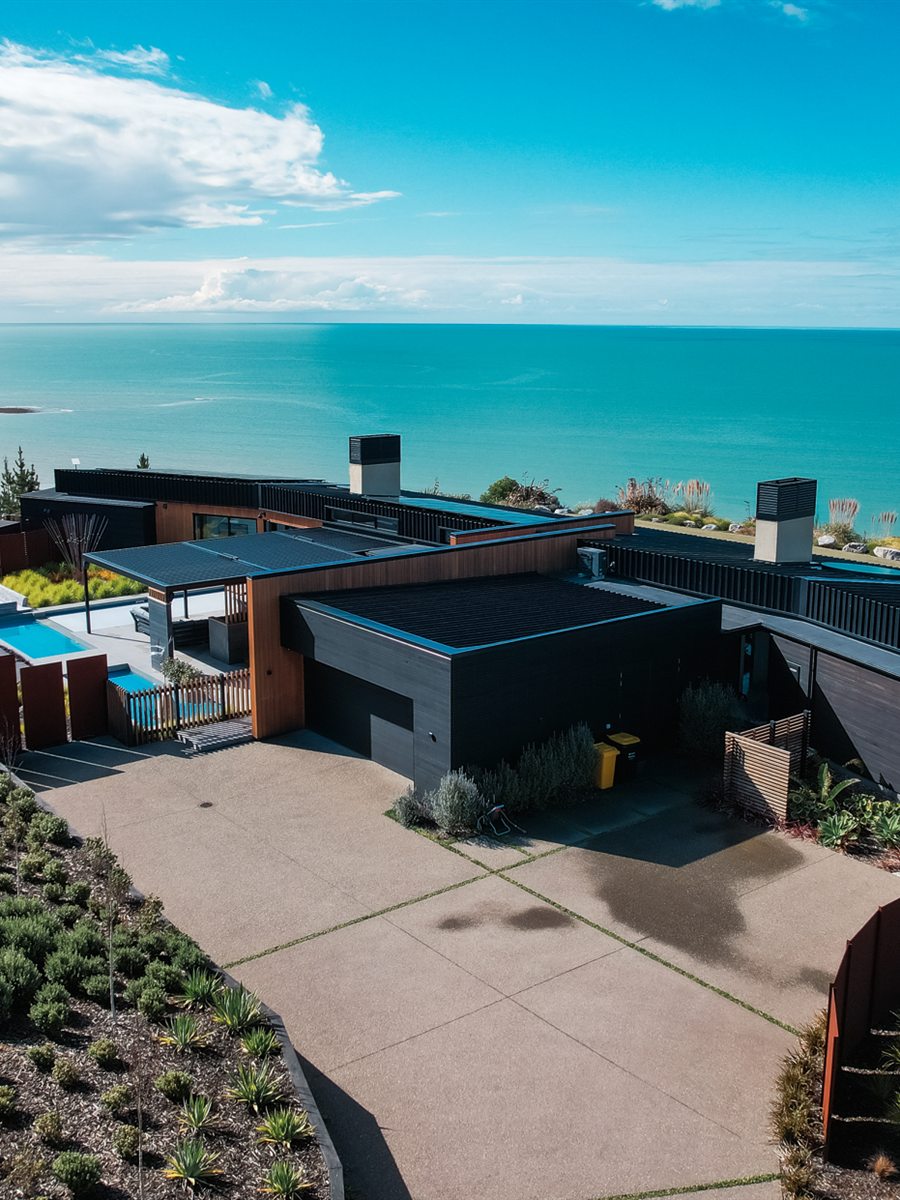
Breathtaking, panoramic images of locations, properties and events.
About
We put a camera above your site to get you better information, faster. Map a block, market a property, track how a place changes over time. Quickly, safely and affordably.
Every job comes back as something you can actually use: imagery you can measure off, models you can share by link, and footage worth putting on the front page.
View recent projects →Four ways we put a camera where you need it.
Breathtaking, panoramic images of locations, properties and events.
Stunning bird's-eye views of landscapes, properties and events, cut to length.
Large areas captured quickly and measurably. Ideal for planning or environmental work.
Detailed 3D models for construction, infrastructure development and land management.
Deliverables
Plain English, because the acronyms hide the useful part.
A note on accuracy: how closely a map or model matches the ground depends on the site. Terrain, vegetation, shadow, weather and flying height all play a part. Treat these as detailed reference tools, not legal measurements.
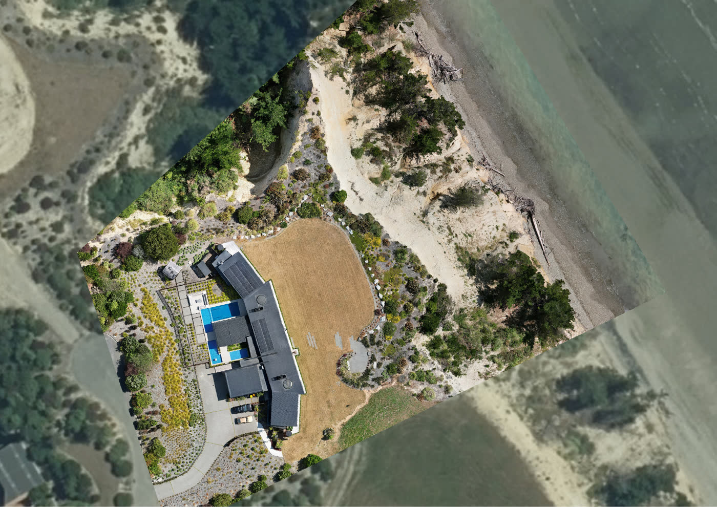
One distortion-corrected, scaled photograph of the whole site. Measure distances and areas straight off it.
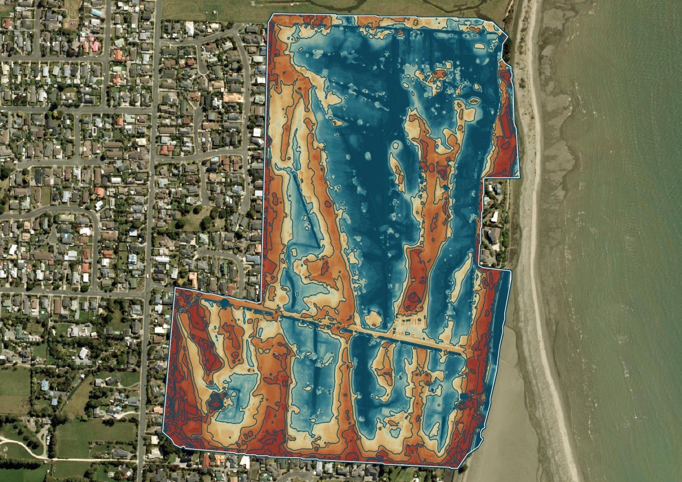
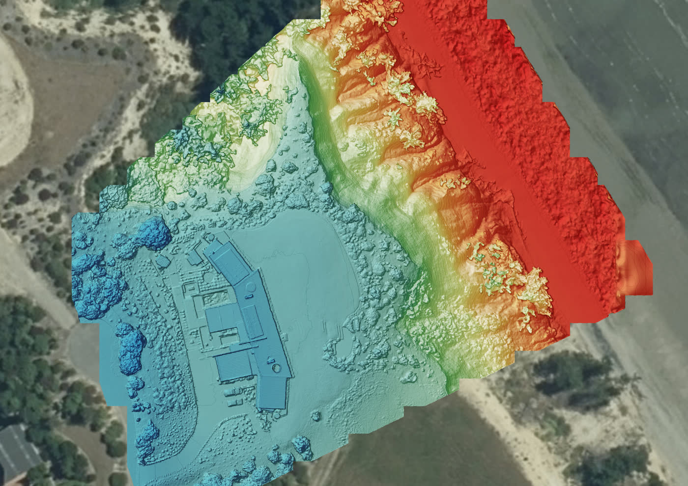
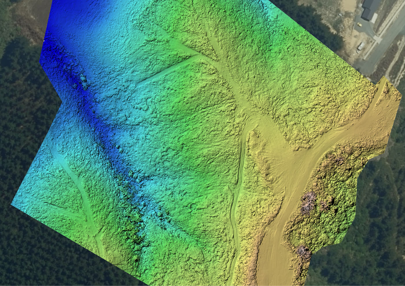
A height value for every pixel. Handy for looking at slope, drainage and rough volumes.
Millions of 3D points: the raw record of the site, ready to drop into your own software.
Contour lines at whatever interval suits you, plus a textured 3D model you can spin in any browser.
Why choose us
Hundreds of flights across the top of the South, and current-generation gear that gets you clear, detailed imagery of your site.
Current technology with a customer-first approach. We build the job around what you need, not around a template package.
High-resolution imagery and proper processing, turned around fast. Detailed maps and 3D models at a sensible price.
Coverage
No travel charge inside 40 km of Nelson. Beyond that, we quote travel at cost. We regularly fly Golden Bay, Murchison and Marlborough.
It depends on the job. Terrain, ground cover, tree and building shadow, weather, light and how much of the site we can see from above all affect the result, so we won't put a single number on it. We'll tell you what to expect for your site before we fly, and we'll be straight with you if the conditions won't give you what you need. Our outputs are reference tools rather than legal measurements.
Up to about 120 acres in a flight day. Terrain and airspace can change that, so we confirm it once we've seen the boundary.
Up to 1 cm per pixel, depending on the size of the site and how high we need to fly to cover it. Bigger areas mean a slightly coarser map; small sites can be very fine indeed.
Real estate, construction, agriculture and environmental monitoring, mostly, and we tailor the deliverables to each.
Yes. Business liability cover up to $10 million, and we operate under CAA Part 101 rules. Read the rules here.
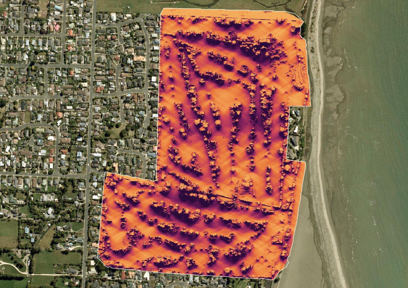
43.5 hectares at 1.8 cm/px: orthomosaic, contours and colour elevation models, plus shade and ponding studies from the same flight.
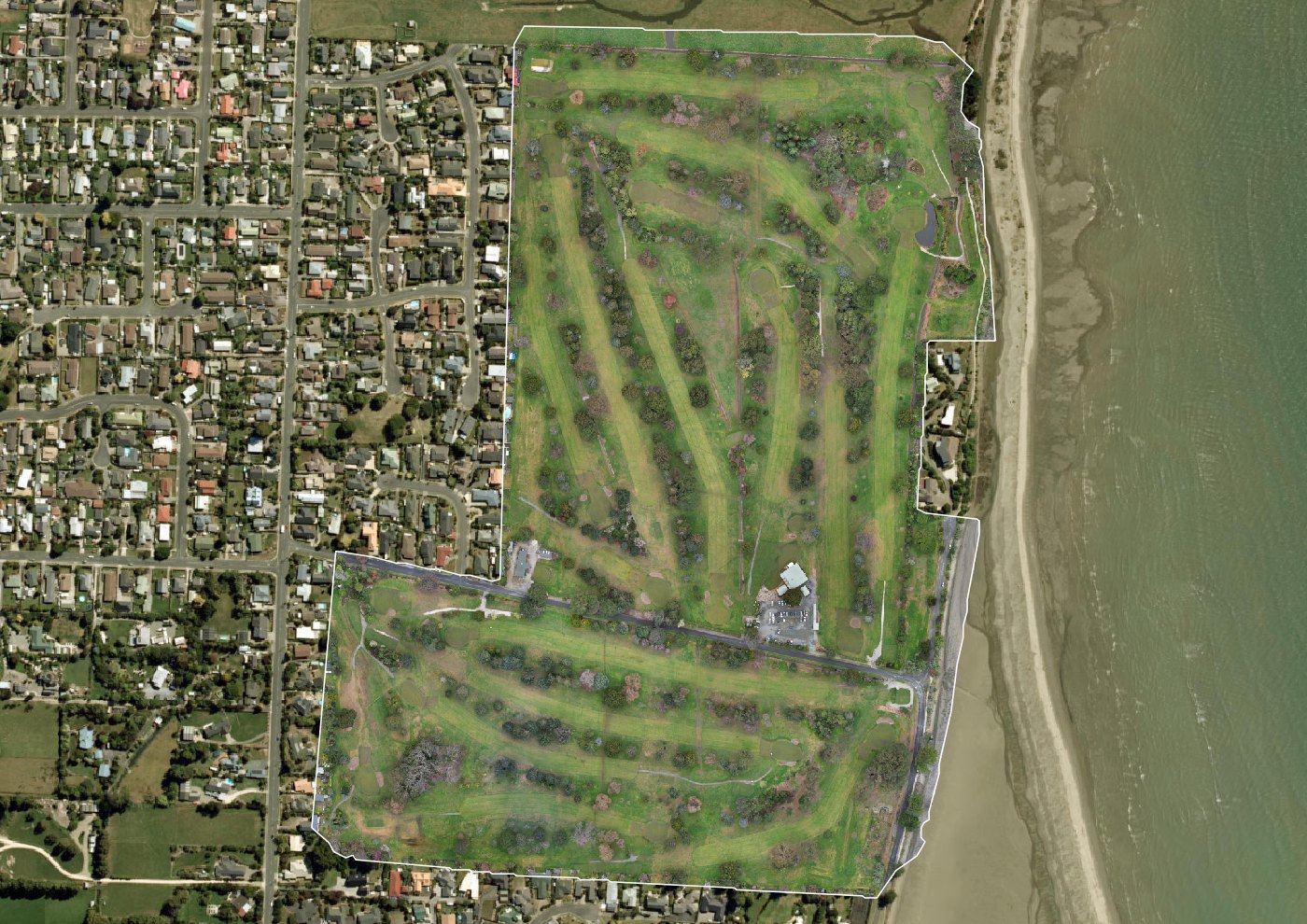
Full-property orthophoto flown for a rural listing, with access and topography readable at a glance.
Repeat flights over an active coastal site, delivered as a contour set and progress comparison sheets.
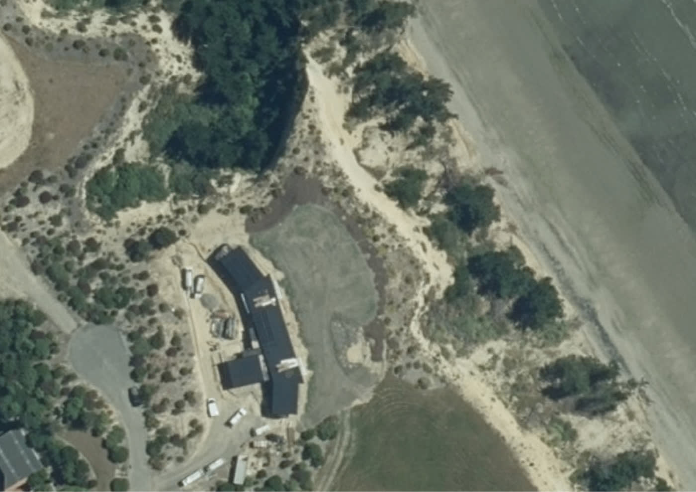
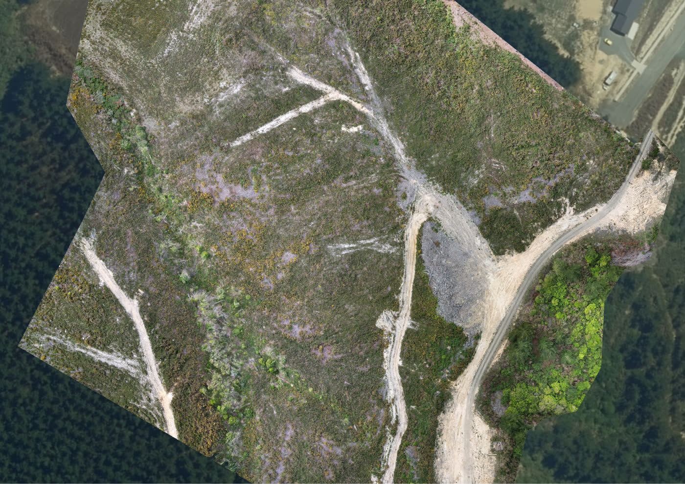
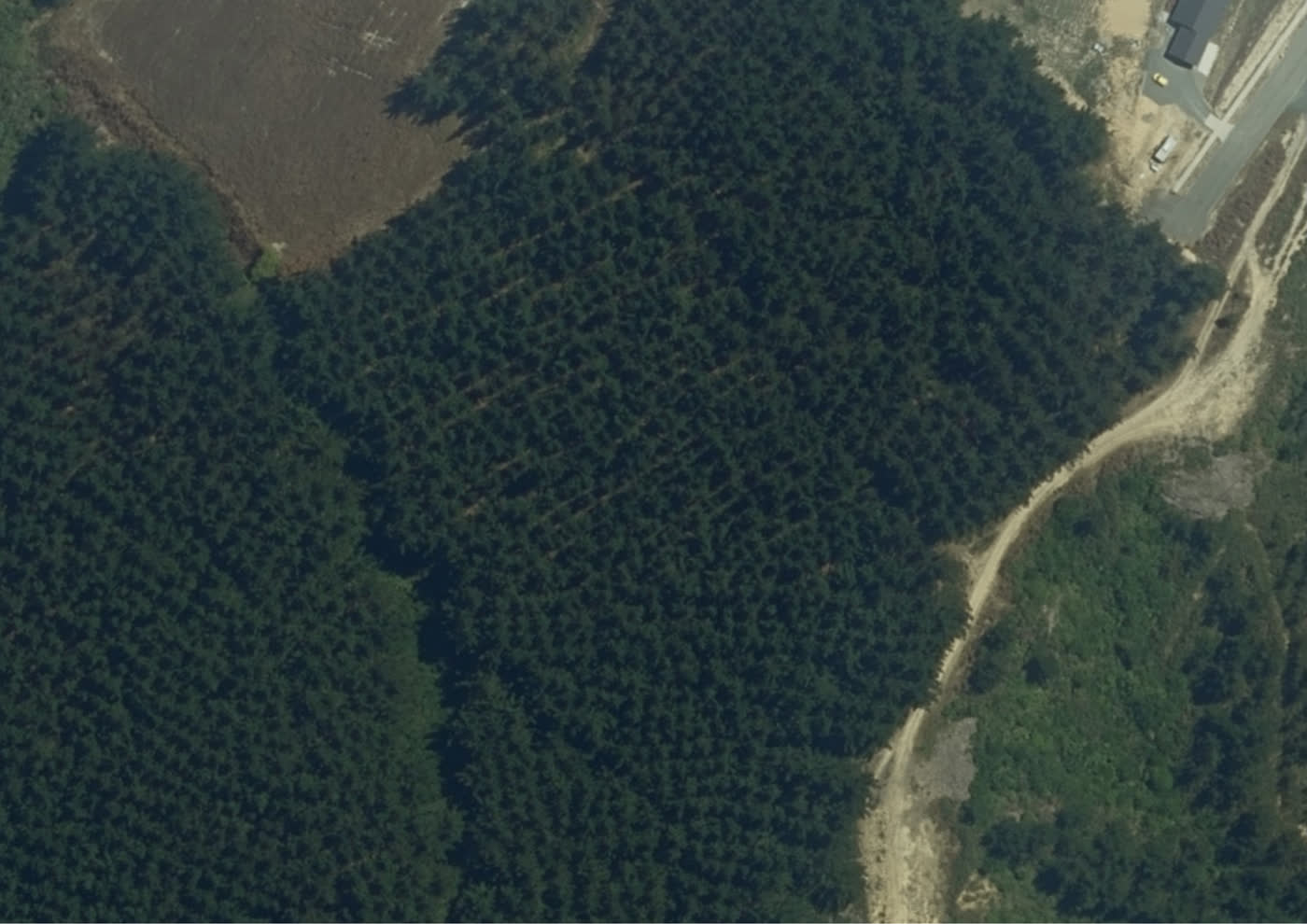
Canopy and terrain mapping across a working block, with a 2D elevation map for harvest planning.
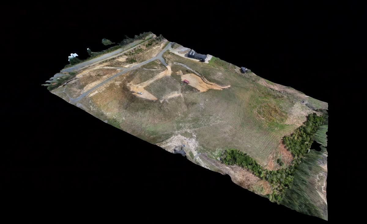
Full-property capture turned into a navigable 3D model for planning access and drainage.
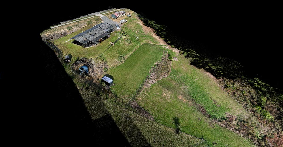
Dense point cloud of house and grounds, with every roof plane and retaining wall visible.
Get a free quote for your project. Tell us the site and we'll come back with a number and a timeline.
Free quoteTuesday – Sunday
09:00 – 18:00
Nelson, New Zealand
Flying Nelson, Tasman, Golden Bay, Marlborough and the West Coast.
The more you can tell us about the site, the sharper the number.
Last updated 10 September 2026
Aerial Insights is an aerial mapping, modelling and media business based in Nelson, New Zealand. This policy sets out what personal information Aerial Insights collects, the purposes for which it is collected, and how it is stored, used and disclosed.
Personal information is handled in accordance with the Privacy Act 2020 and its information privacy principles. The privacy officer is Liam Richards, who can be contacted at liam.richards@aerialinsights.co.nz or on 021 024 65937.
Where an enquiry is made through the quote form on this website, or by email or telephone, Aerial Insights collects the name, email address, telephone number and site location provided, together with the service requested and any details supplied in the message. This information is collected in order to assess and quote the work. Supplying a telephone number is optional.
The website is hosted by Cloudflare, which records standard technical information including IP address, browser type and pages requested, for the purposes of delivering the site and protecting it against misuse. Cloudflare Web Analytics is also enabled, and reports aggregate figures such as page views, referring sites and country of origin. It does not set cookies and does not track visitors across other websites.
This website sets no cookies. Where a visitor selects the light or dark appearance, that preference is recorded in the browser's local storage under the key ai-theme. It remains on the visitor's device and is not transmitted to Aerial Insights.
Aerial work produces imagery of land and buildings, which may incidentally include people, vehicles and neighbouring property. This imagery is collected in order to produce the maps, models, photographs and video that the client has engaged Aerial Insights to supply.
Civil Aviation Rule Part 101 requires the consent of the occupier of the land overflown, and of persons overflown. Clients are asked to identify any other persons likely to be present on site at the time of the flight.
A person who is not a client of Aerial Insights, and who believes that imagery has captured them or their property in a manner that causes them concern, may contact Aerial Insights at the address above.
Personal information is used for the following purposes:
Personal information is not sold. Marketing email is not sent to persons who have only made an enquiry.
Imagery produced in the course of a job may be used to promote the services of Aerial Insights, as set out in clause 6 of the terms of service.
Aerial Insights uses a small number of third party services in order to operate. Several of these are located outside New Zealand, and the transfer of personal information overseas is a disclosure for the purposes of the Privacy Act 2020. Those services are:
Personal information may also be disclosed where disclosure is required by law, or is necessary to prevent or lessen a serious threat to the life, health or safety of any person.
Enquiries and correspondence are held within the Aerial Insights email system. Project files and imagery are held on systems controlled by Aerial Insights, together with backups. Reasonable safeguards are maintained against loss, misuse and unauthorised access.
Enquiry details are retained only for so long as there is a lawful purpose for holding them, ordinarily for the duration of a job and for a reasonable period afterwards. Records required for taxation purposes are retained for seven years. Project imagery is retained so that deliverables can be re-supplied, unless deletion is requested.
Where a privacy breach occurs that is likely to cause serious harm, Aerial Insights will notify the affected individuals and the Office of the Privacy Commissioner, as required by the Privacy Act 2020.
Any individual may request confirmation of whether Aerial Insights holds personal information about them, request access to that information, and request its correction where it is inaccurate. Requests should be sent to liam.richards@aerialinsights.co.nz and will be answered within 20 working days. No charge is ordinarily made.
Complaints about the handling of personal information should be directed to Aerial Insights in the first instance. Where a complaint is not resolved to the complainant's satisfaction, it may be referred to the Office of the Privacy Commissioner at privacy.org.nz or on 0800 803 909.
This policy may be amended from time to time. The date shown at the head of this page indicates when it was last amended.
Last updated 10 September 2026
These terms apply to all aerial mapping, modelling and media services supplied by Aerial Insights of Nelson, New Zealand. They apply together with any written quote issued for the work. Where a quote and these terms are inconsistent, the quote prevails.
Quotes are prepared on the basis of the information supplied by the client concerning the site, including its area, terrain, access and the deliverables required. Where conditions found on site differ materially from that information, Aerial Insights will consult the client before undertaking additional work.
Prices are quoted exclusive of GST unless stated otherwise. Quotes remain valid for 30 days from the date of issue.
Aerial work is dependent on weather, wind and light. Aerial Insights will not fly where conditions would produce unsatisfactory data or render the flight unsafe, and will reschedule instead. Aerial Insights is not liable for costs incurred by the client as a result of a flight being postponed for reasons of weather or safety.
The client is responsible for arranging safe access to the site, for notifying Aerial Insights of any hazards, and for holding the authority necessary to permit a flight over the land. Where a flight cannot proceed because access or authority was not in place, Aerial Insights may charge for the attendance.
Aerial Insights operates under Civil Aviation Rule Part 101, which imposes restrictions on where and how flights may be conducted, including in the vicinity of aerodromes, within controlled airspace, and over persons or property without consent. Certain sites require authorisations that take time to obtain, and certain sites cannot be flown at all.
Aerial Insights will advise the client before booking where a site is believed to be constrained. Where a rule, airspace restriction or air traffic instruction prevents a flight, the work will be rescheduled or the fee refunded.
The deliverables for each engagement are specified in the quote, and ordinarily comprise some combination of orthomosaic, elevation model, point cloud, contours, textured mesh, photographs and video.
Maps and models supplied by Aerial Insights are high-resolution reference tools and are not legal documents. Their accuracy depends upon site conditions, including terrain, ground cover, shadow, weather and flying height. Aerial Insights is not a licensed cadastral surveyor. Deliverables must not be relied upon to define legal boundaries, or for any purpose requiring a cadastral survey under the Cadastral Survey Act 2002. Where legally binding measurements or boundary definitions are required, a licensed cadastral surveyor must be engaged.
Where the client notifies Aerial Insights in advance of a required accuracy, Aerial Insights will advise whether that requirement can be met.
Section 21(3) of the Copyright Act 1994 provides that, where a person commissions and pays for photographs or film, that person is the first owner of the copyright unless the parties agree otherwise. The parties agree otherwise, on the following terms.
Where a client requires ownership of the copyright, this must be raised before the flight is undertaken so that the work can be priced accordingly.
The client acknowledges and agrees that Aerial Insights may use imagery, data and models produced in the course of an engagement to promote its own services, including on this website, in printed material and on social media. No further permission is required, and no fee is payable to the client for that use.
Aerial Insights will not publish material that identifies the client by name, or the address of the site, without the client's agreement.
Where a client does not wish particular imagery to be published, the client should notify Aerial Insights, and that imagery will be withheld from promotional use.
Unless the quote provides otherwise, invoices are payable within 14 days of the invoice date. Aerial Insights may withhold deliverables until payment has been received. A deposit may be required for larger engagements.
A booking may be cancelled without charge up to 24 hours before the agreed time. Where a booking is cancelled within 24 hours, Aerial Insights may charge for time already committed. No charge arises where Aerial Insights cancels for reasons of weather, safety or airspace.
Aerial Insights holds business liability insurance and exercises reasonable care and skill in the performance of its services. The following limitations apply to the extent permitted by law.
Where the client acquires services as a consumer, nothing in these terms limits or excludes any right the client has under the Consumer Guarantees Act 1993 or the Fair Trading Act 1986. Those rights prevail over anything stated in these terms.
Where the client acquires services for the purposes of a business, the parties agree that the Consumer Guarantees Act 1993 does not apply, and that the total liability of Aerial Insights in respect of any claim arising in connection with the services is limited to the amount paid by the client for those services. Aerial Insights is not liable for indirect or consequential loss, including loss of profit or loss of opportunity.
Aerial Insights is not liable in respect of decisions taken on the basis of its deliverables where those decisions required a cadastral survey, a professional engineering assessment, or other professional advice not provided by Aerial Insights.
Personal information is handled in accordance with the privacy policy.
These terms are governed by the laws of New Zealand, and the New Zealand courts have exclusive jurisdiction in respect of any dispute arising under them.
These terms may be amended from time to time. The terms applicable to an engagement are those current at the date the quote was issued. The date shown at the head of this page indicates when this page was last amended.